

A two-year project in coordination with a $13,270 culture and tourism grant from Iron Range Resources & Rehabilitation has resulted in interactive trail maps now available online and in print copies at locations across the Iron Range. The process of creating the maps also involved an analysis of trail systems and led to updates to trail signage across the East Range.
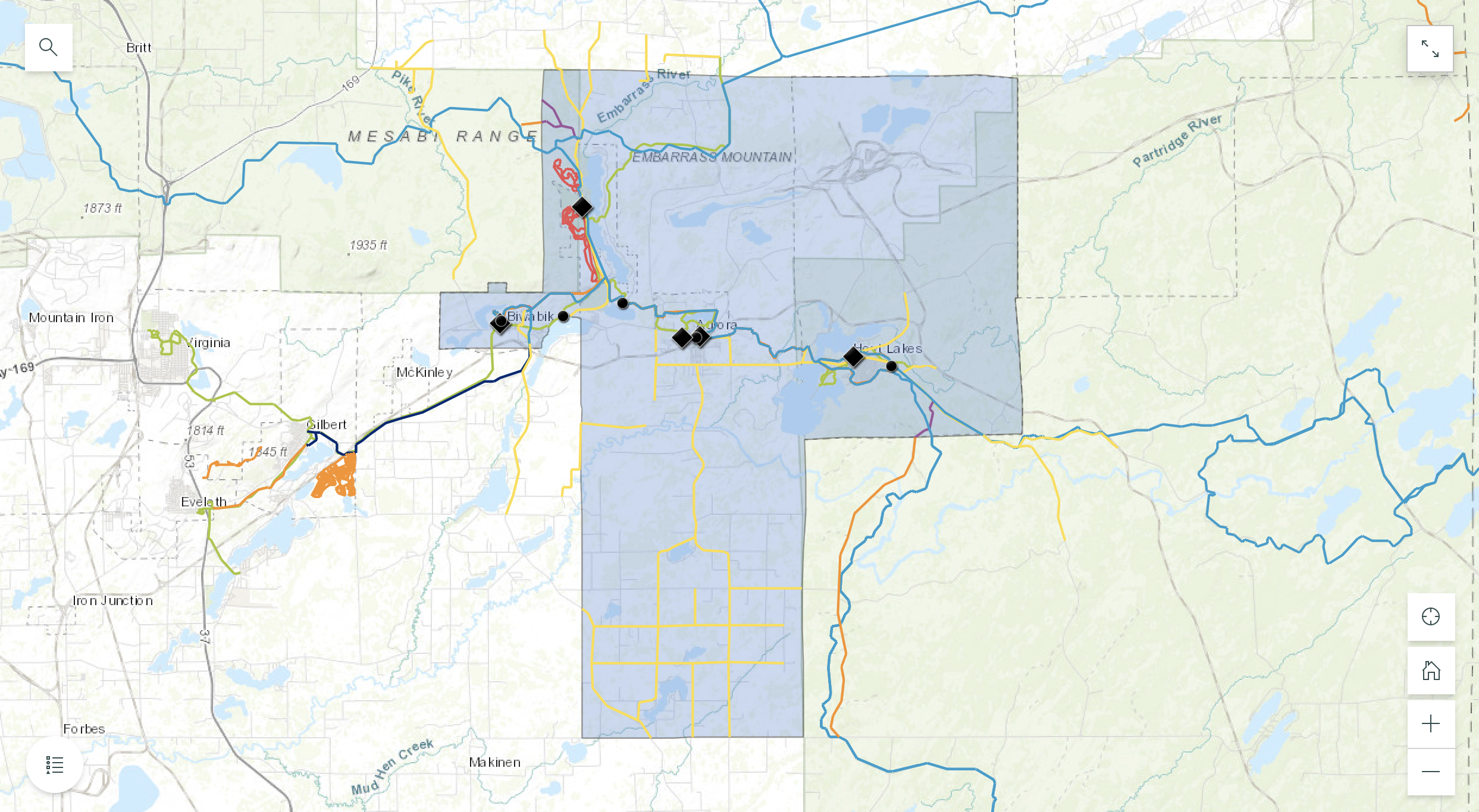
The maps trace the East Range’s robust trail networks for snowmobiling, off-highway vehicles (OHVs or ATVs), as well as pedestrian and bike trails. Together, these routes provide a wide array of recreation options for outdoor enthusiasts — both Range residents and visitors from elsewhere, alike. The new maps are designed to help people learn about and explore the full breadth of these opportunities.
The trail maps are digitally accessible on websites including erjpb.org, as well as popular mobile apps like Ride Command, allowing visitors to discover highlights such as:
- The East Range snowmobile trails from the North Shore and Ely to the downtowns of Biwabik, Aurora, and Hoyt Lakes
- The Iron Range OHV State Recreation Area in Gilbert
- Paved trails such as the 135-mile Mesabi Trail, stretching from Biwabik to Aurora and beyond
- Mountain biking and recreational opportunities at locations like Giants Ridge
“The coordination with websites and mobile apps is a major step forward for trail information on the East Range. It gives state-of-the-art options for local and visiting trail users to explore the area,” Karl Schuettler, ERJPB consultant, told IRRR for the April 2022 edition of The Ranger. “These innovative tools boost the East Range’s digital presence and help market the region to both tourists and locals. The project is very timely given the uptick in demand for outdoor recreation the past several years.”
The effort brought together several local vendors. Hibbing’s Barr Engineering led the mapping process, while Express Print, also of Hibbing, designed and printed the maps. The paper maps have now been distributed to the Iron Range Tourism Bureau, Giants Ridge, as well as a variety of East Range businesses and city halls.
The process also revealed opportunities to improve the existing trail systems. An example is a proposed trail to connect Aurora to Hoyt Lakes. The Ranger Snowmobile & ATV Club is in the process of exploring these options and installing updated signage across the trail networks.
Led by ERJPB with funding from IRRR, the project was also supported by:
- Aurora Chamber of Commerce
- Biwabik Area Civic Association
- Country Inn of Hoyt Lakes
- Fisherman’s Point Campground (Hoyt Lakes)
- Giants Ridge
- Hoyt Lakes Chamber of Commerce
- Iron Range Tourism Bureau
- Minnesota Department of Natural Resources and Arrowhead Regional Development Commission
- St. Louis County
- Vermilion Trail Campground (Biwabik)
You can learn more and explore the maps on arcgis.com: East Range Trail Maps